Places to Watch: A Starting Point for Investigating Deforestation
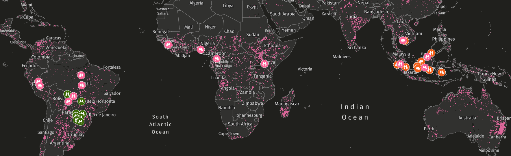
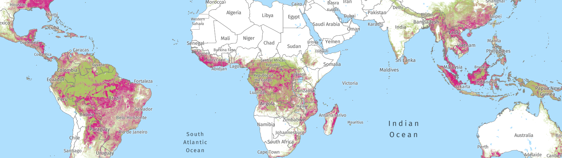
Advances in forest monitoring data have led to an abundance of information on when and where forests are being cleared, including a proliferation of alert systems that detect loss and disturbance in near-real-time.
These systems generate millions of deforestation and disturbance alerts every day. While this provides valuable information, not all alerts are priority deforestation events — meaning not all alerts require further investigation or action. Additionally, the sheer volume of alerts makes it difficult and time-consuming to identify which ones are the most concerning and where further investigation should be prioritized.
Places to Watch cuts through the noise with a method that helps identify which alerts correspond to globally important forest areas under threat. It filters millions of alerts based on specific criteria, making it easier to see some of the most concerning instances of recent clearing.
These places are shared directly with interested media, journalism and advocacy groups to help them identify where to investigate, raise public awareness about areas of concern, and apply pressure on those responsible, ultimately helping to prevent further harm to forests and the people who depend on them.
How are Places to Watch identified?
Places to Watch — available on the Global Nature Watch (formerly Global Forest Watch) map — was originally developed in 2017 to flag hotspots of the most concerning alerts, including potential illegal deforestation, within the most critical forests around the globe.
To identify these hotspots, Places to Watch uses an automated system to filter millions of alerts from recent months to determine those within high value areas of either primary tropical forests or intact forest landscapes that overlap protected areas, while filtering out any alerts within plantations or areas of prior tree cover loss.* It then identifies 5×5 kilometer areas with the largest number of alerts in each region. Our team then manually uses contextual data — like fire alerts, Indigenous People and Community Lands, and Key Biodiversity Areas — and satellite imagery to identify the drivers of the alerts and provide additional context, filtering out any locations that don’t have clear disturbances or where disturbances are likely from natural causes. From this larger pool of potential locations, we identify 5-10 priority locations on a quarterly basis by considering factors such as geographic diversity, ecological risks, prior reporting coverage and available supporting evidence, and compile these locations for sharing.
To learn more about the Places to Watch methodology, read our technical note.
The Places to Watch Process
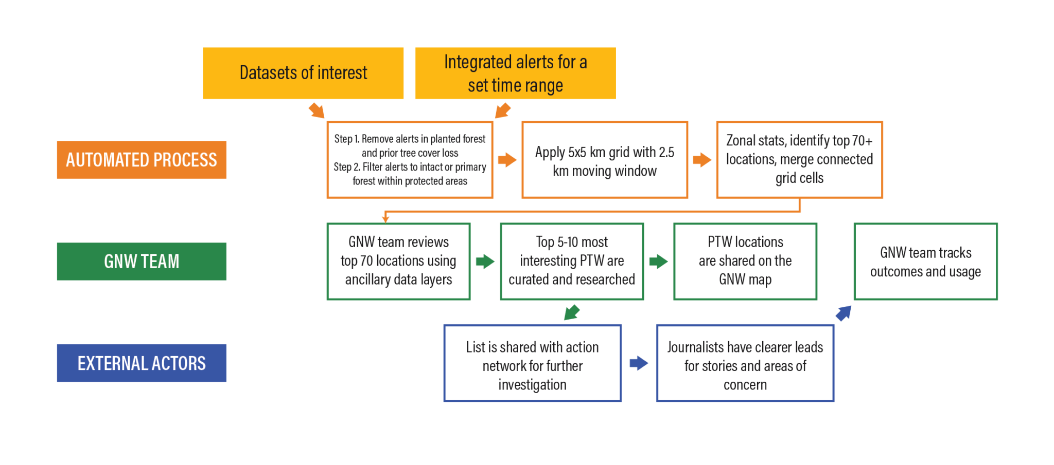
Actionable leads to prompt deeper investigation
Once these Places to Watch locations have been identified and evaluated, the Global Nature Watch team shares them with interested journalists, activists and investigators. Sharing directly reduces barriers to access for any individuals with less technical experience and provides timely, actionable leads they can use to prioritize time, funding and resources for investigation, with the goal of raising visibility around emerging forest threats worldwide.
Locations are shared as potential areas of concern. As with most geospatial data, on-the-ground investigation or additional field intelligence is required to fully validate what’s happening in each location. This is precisely the value of Places to Watch: these locations are intended as investigative leads — or “tips” — for journalists, who can conduct further research and gather information that supports the identification of concerning forest loss where action may be required.
Real-world impacts
Places to Watch has proven to be a useful starting point for investigative journalists reporting on the locations, causes and context of deforestation across the globe.
Through a previous partnership** with Global Nature Watch (at the time Global Forest Watch), investigative journalism network Mongabay has used Places to Watch locations to inspire many deeper on-the-ground investigations.
For example, in 2023, Mongabay investigated a new clearing identified by Places to Watch within the Botum Sakor National Park in Cambodia, where 30% of its area of primary tropical forest had already been lost between 2002 and 2023. Mongabay journalists discovered that the new clearing was led by politically connected business tycoons and reported that the land was being carved up at the expense of the ecosystem and local communities. Mongabay published an update on this investigation in 2024.
![Excavators gouge a muddy hole into the soil of Botum Sakor National Park where forest once stood. Royal Group’s new SEZ [special economic zone] will consume one of the last pockets of forest in the national park.](https://content.globalforestwatch.org/wp-content/uploads/2026/08/Picture1.jpg)
Satellite information combined with deeper investigation also exposes the human realities behind the data. In another example in 2024, Places to Watch detected a surge in deforestation alerts across protected areas in central Colombia — including Llanos del Yarí Yaguara II Indigenous Reserve, Tinigua National Natural Park, and Sierra de la Macarena National Natural Park — after a brief decline in deforestation rates in 2023. Tipped by the surge in alerts, Mongabay’s investigation found that armed groups emboldened and funded by the drug industry had increased their control in these protected areas, and the surge in clearings were linked to agricultural expansion, cultivation of illegal crops like coca and marijuana, and illegal gold mining. The investigation shed light on the monitoring agencies and local residents in the area who feared reprisal if they spoke out against harmful activity, demonstrating how journalism can give a voice to people on the frontlines of deforestation.
These examples and numerous others show how Places to Watch surfaced a strong lead for investigative journalism and helped journalists prioritize where they invested their time and resources. This helped drive investigations and made information publicly available that could be used to inform actions by policy makers and other interventions, such as law enforcement.
Subscribe to Receive Places to Watch
You can explore Places to Watch locations on the Global Nature Watch map. The Global Nature Watch team also shares Places to Watch locations with a network of journalists, media and advocacy partners.
If you are interested in receiving regular reports of these locations, please subscribe to our newsletter and select “Places to Watch” under interests.
By subscribing, recipients understand that Places to Watch locations should be interpreted as early indicators of potentially concerning forest disturbances that warrant further investigation. These locations are identified through an automated system based on satellite data. There may be errors in the underlying data and locations always require on-the-ground investigation or additional field intelligence to validate the nature of the disturbance.
* Our method assumes that intact forest landscapes, primary forests and protected areas adequately represent areas that are most important to our users. Although protected forests are associated with high biodiversity and carbon value, they are not the only measures of conservation value and thus Places to Watch will miss other important sites of forest loss.
** Mongabay’s partnership and investigation of Places to Watch was supported by a Global Nature Watch (at the time Global Forest Watch) grant between 2018-2025.