SHOWING 6 OF 22 POSTS
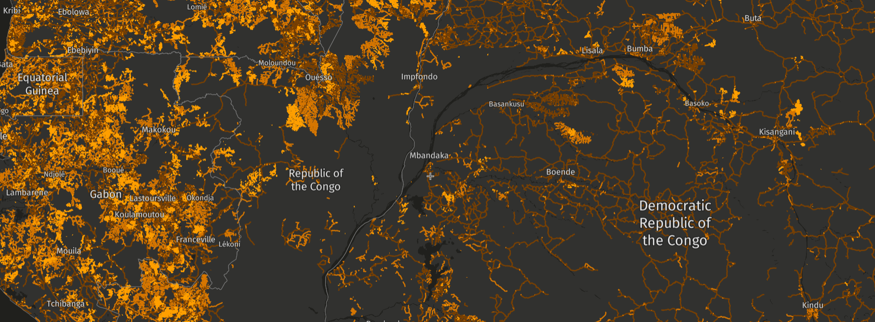
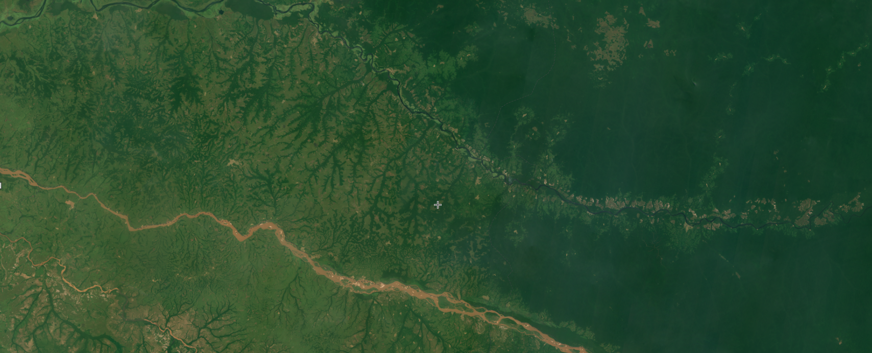
In Congo Basin forests, roads can cause big changes. A new, high-res data set on GFW provides a detailed view of these forest roads.
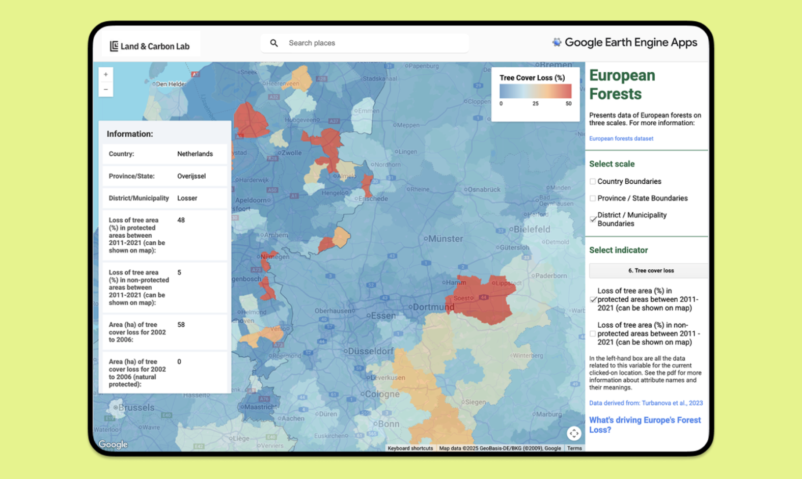
A new European Forest App supports better monitoring of European forests by providing tailored information and insights in an easy-to-use platform.
New data on GFW shows drivers of tree cover loss at 1-kilometer resolution, providing the most detailed view of drivers yet.
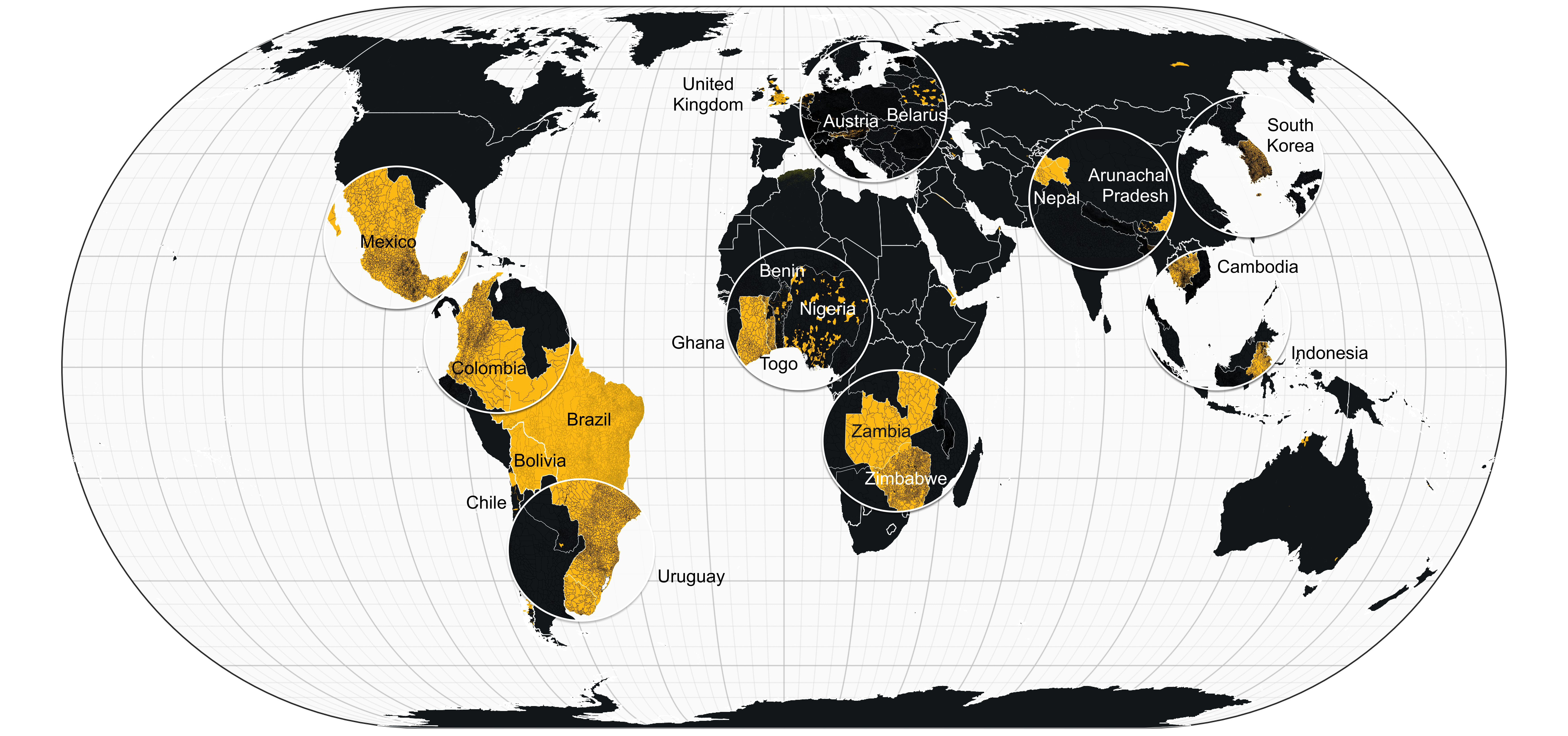
We’ve updated the political boundaries available on GFW using the latest and most accurate information. Learn about the changes in our blog.
Planet imagery is no longer available on GFW as of April 1 2025, but GFW continues to provide other satellite imagery. Here’s what you should know.
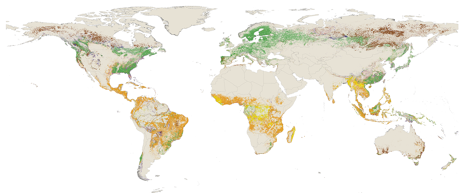
New natural forest data on GFW reveals where the world’s natural forests are located and provides a baseline for monitoring loss within them.